A complete solution to create, maintain and integrate stunning 3D maps in your applications.
.svg)


.svg)

Create or edit your map by using simple shapes in a 2D space. Upload your reference files and simply draw over them, create your routing network with dedicated tools and publish your map in minutes.
Show me more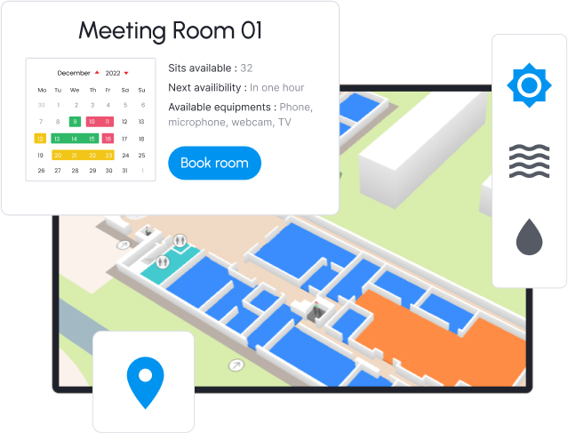
Elevate and customize your experience to your needs for a comprehensive view of operations. Connect with the technologies you already use such as asset and facility management and indoor positioning.
Get in touch
Power your applications on both desktop and mobiles with a single map. Choose to view your map in 3D or in 2D if it suits your style. The choice is yours!
Show me more
Create or edit your map by using simple shapes in a 2D space. Upload your reference files and simply draw over them, create your routing network with dedicated tools and publish your map in minutes.
Get in touch
Power your applications on both desktop and mobiles with a single map. Choose to view your map in 3D or in 2D if it suits your style. The choice is yours!
Get in touch
Elevate and customize your experience to your needs for a comprehensive view of operations. Connect with the technologies you already use such as asset and facility management and indoor positioning.
Get in touchDesigned with simplicity in mind, our tools are easy to learn and use. Just four hours of training are required to create a map from scratch and even less for editing and maintenance. Seamlessly integrate our toolkit into your applications in under a day.


Our maps are easy to customize and maintain. One map can support multiple device types and can be connected to any technology you already use. We guarantee optimized performance for your applications with compact sizes of both our SDKs and map bundles.
We take pride in the long-lasting relationships we build with our clients and partners. With 16 years of experience as indoor mapping experts, we guarantee the quality and precision of our maps and guide you through the entire creation and integration process.


Easily navigate your space, find resources and available desks. Integrate with the technologies you already use and enhances the workplace experience.
Use case details
Enhance customer experience and optimizing operations. Analyze foot traffic, optimize tenant placement, and streamline facility maintenance. Take your venue to the next level.
Use case details
Help your visitor find their way and enhance their experience from arrival to departure.
Use case details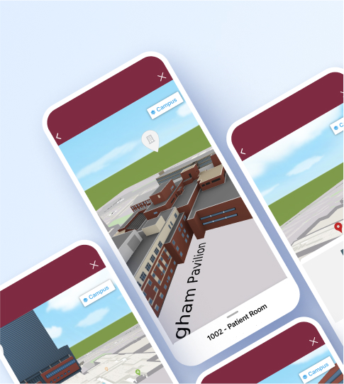
Easily navigate through large buildings and complex indoor spaces, helping patients and visitors find their way to their locations with optimized and customized routes.
Use case details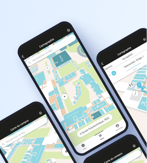
Provide efficient navigation within large buildings and complex indoor spaces. Help students, staff, and visitors to easily locate classrooms, offices, and other facilities.
Use case detailsEasily navigate your space, find resources and available desks. Integrate with the technologies you already use and enhances the workplace experience.
Use case detailsEnhance customer experience and optimizing operations. Analyze foot traffic, optimize tenant placement, and streamline facility maintenance. Take your venue to the next level.
Use case detailsHelp your visitor find their way and enhance their experience from arrival to departure.
Use case detailsEasily navigate through large buildings and complex indoor spaces, helping patients and visitors find their way to their locations with optimized and customized routes.
Use case detailsProvide efficient navigation within large buildings and complex indoor spaces. Help students, staff, and visitors to easily locate classrooms, offices, and other facilities.
Use case details.png)
.png)
.png)


Immeuble Silvaco ZIRST II55, rue Blaise Pascal
38330 Montbonnot Saint Martin
1455, Drummond Street,Office 2B, Montréal,
(QC)H3G 1W3, Canada