Deployed across 1,000+ venues in 15+ countries
1,000+ venues in 15+ countries

Indoor maps that make your venue unforgettable and effortless to manage

Premium 3D indoor maps, real-time updates, and actionable analytics — all from one platform

3D map view of a campus area with labeled buildings, trees, roads, and a search bar at the top.
Navigation map showing a blue route to enter a building with instructions to go straight for about 30 seconds.
Colorful 3D map showing buildings, landmarks, and various numbered plots with icons for dining, information, and services surrounded by palm trees.
Close-up of sushi rolls with salmon, avocado, black sesame seeds, and parsley on a wooden platter.
Microsoft  LogoWestfield Unibai Rodamco  LogoSociété Générale  LogoL'Oréal  LogoOrange Business Services  LogoEverbridge  LogoReady Education  LogoJLL  LogoSchneider Electric LogoHIA  LogoMsheireb  LogoDubai Airports LogoMicrosoft  LogoWestfield Unibai Rodamco  LogoSociété Générale  LogoL'Oréal  LogoOrange Business Services  LogoEverbridge  LogoReady Education  LogoJLL  LogoSchneider Electric LogoHIA  LogoMsheireb  LogoDubai Airports Logo
Benefits

3D maps that adapt to your venue  and power smarter operations

Every industry comes with its own set of challenges — that's why we've built a solution that adapts to your specific environments, with blazing fast maps, effortless updates, and seamless connectivity across all your devices and tools.

Features

The complete toolkit for venues that want to do more

A stunning 3D map from day one, built to evolve with your venue

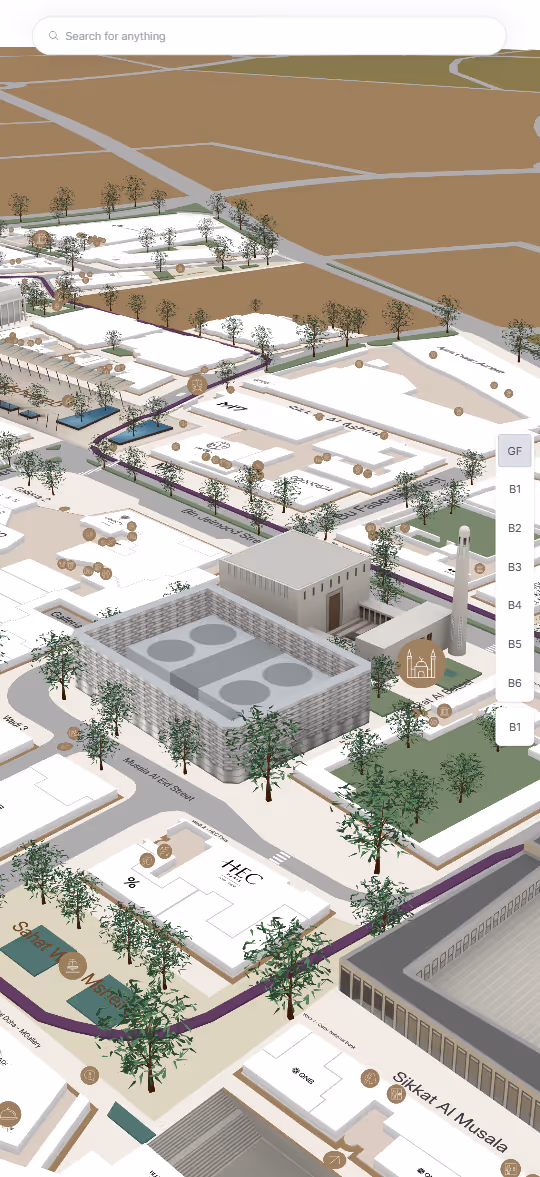
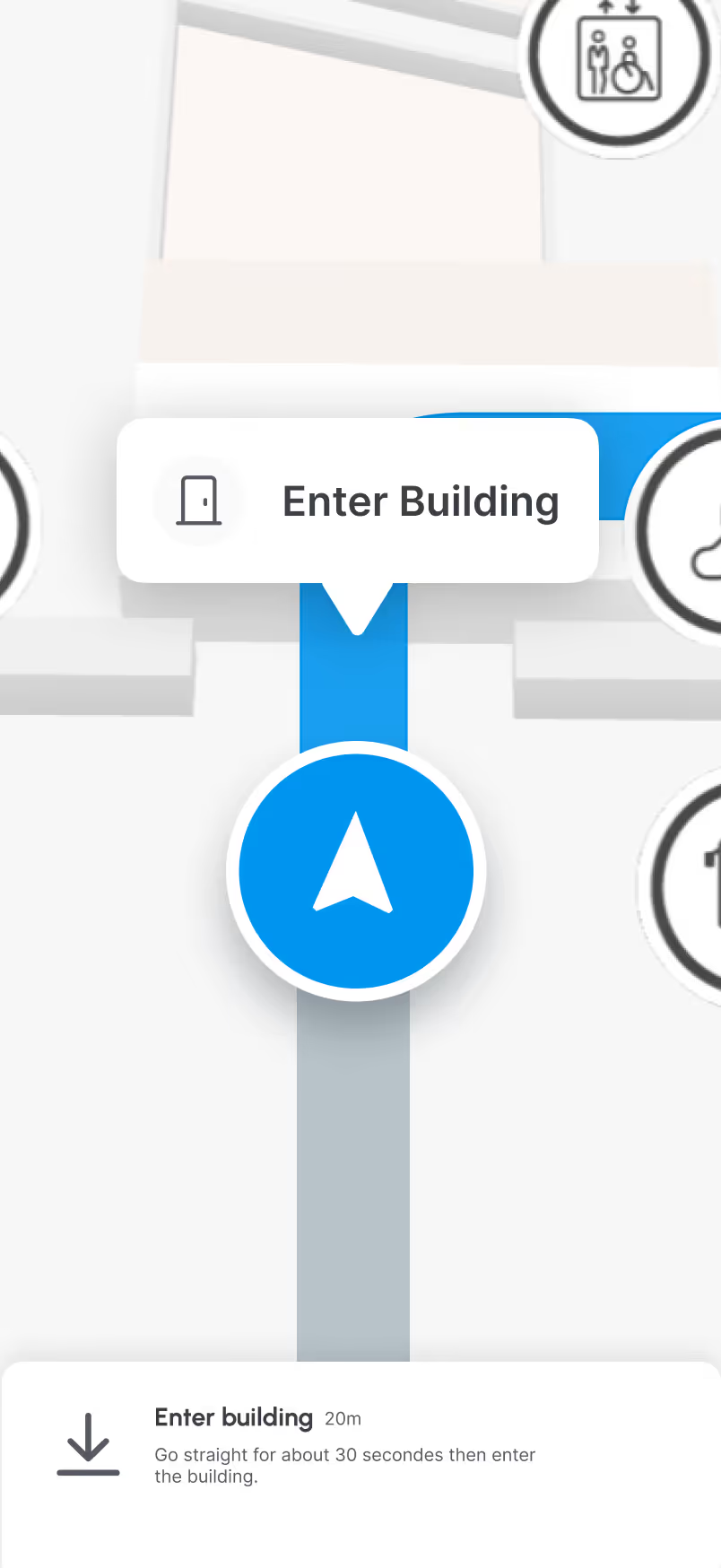
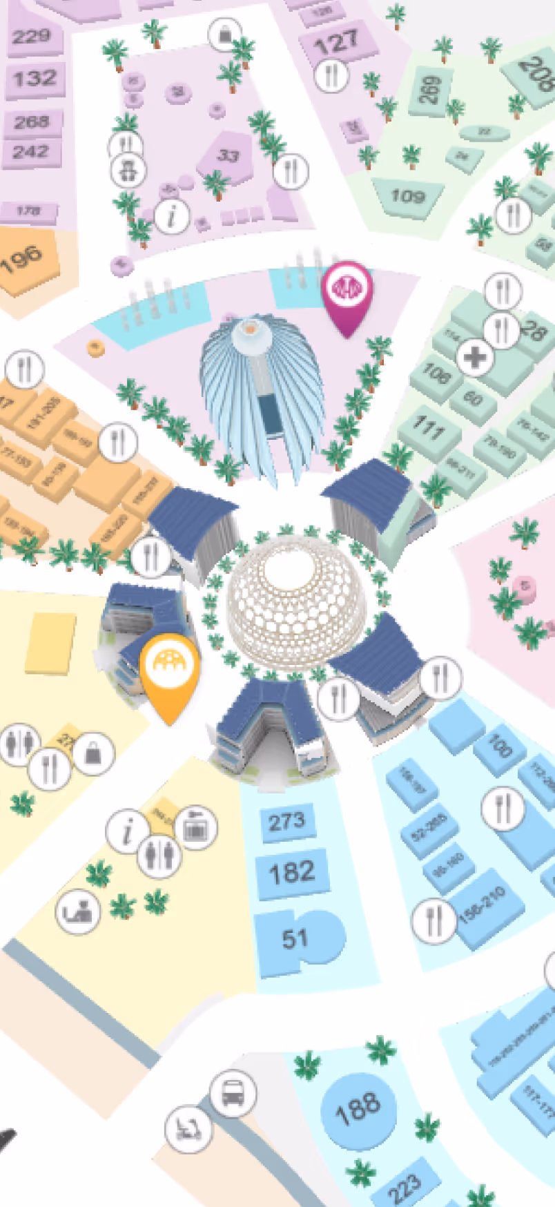
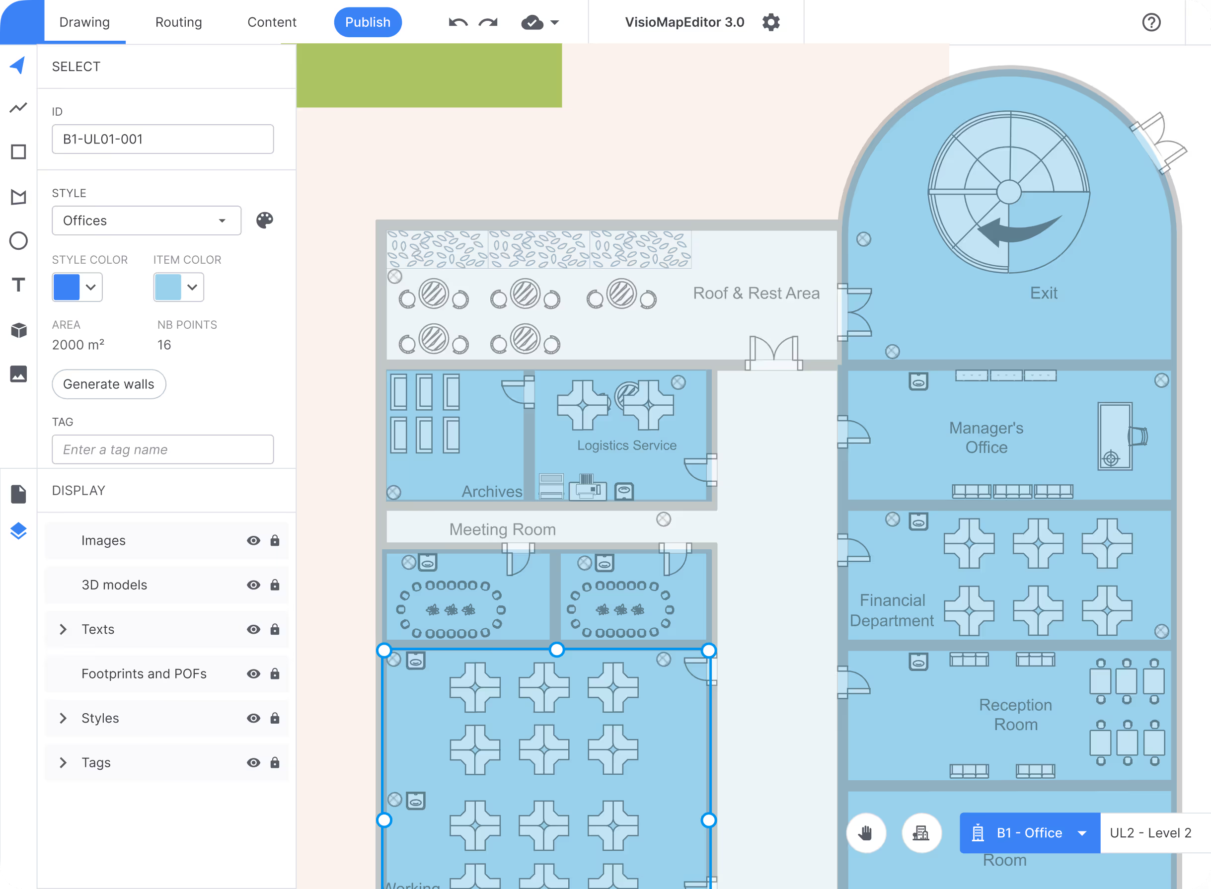
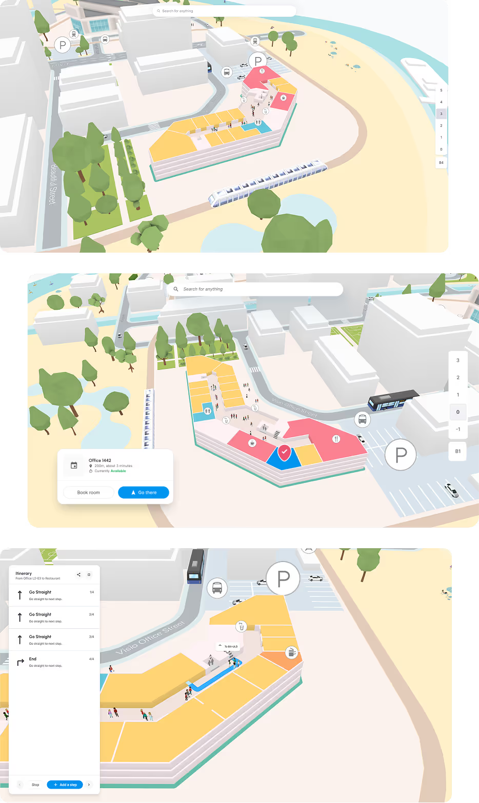
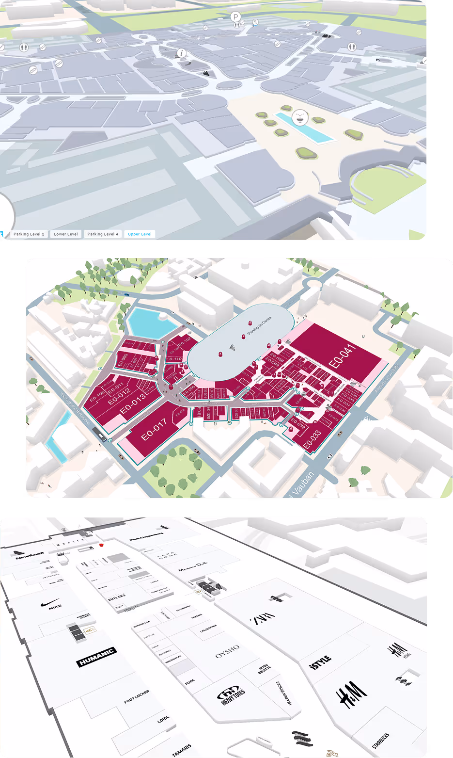
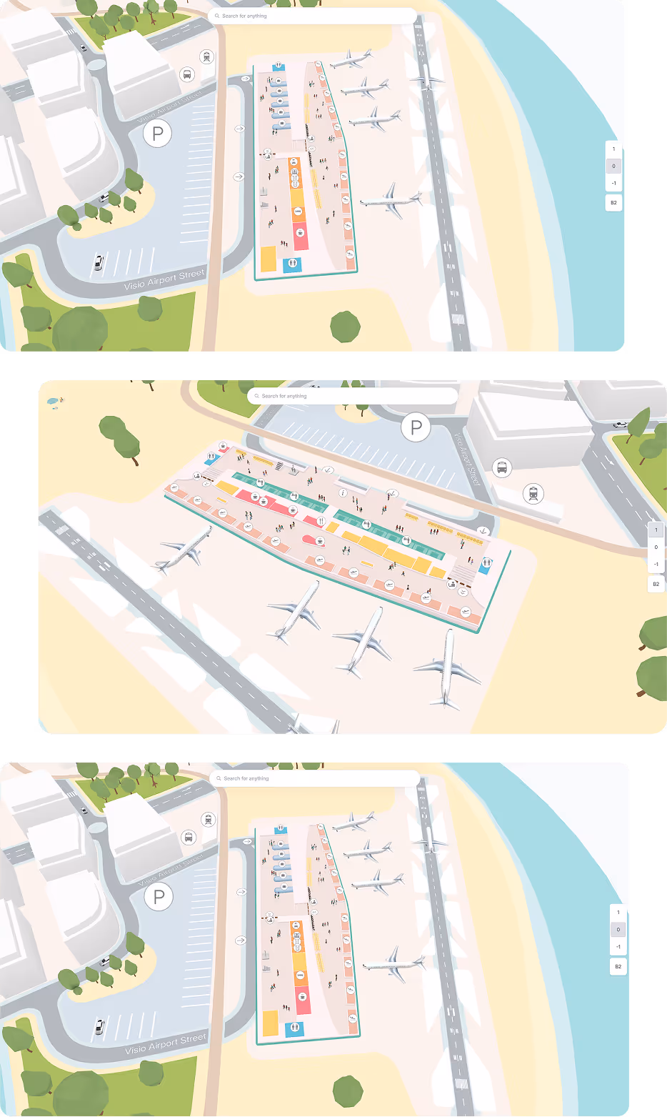
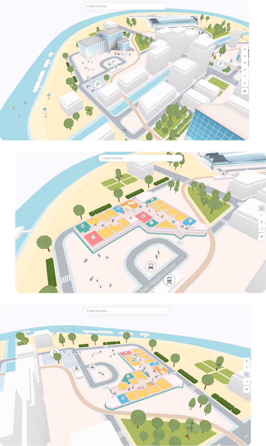
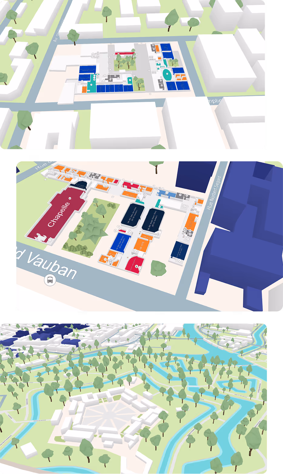
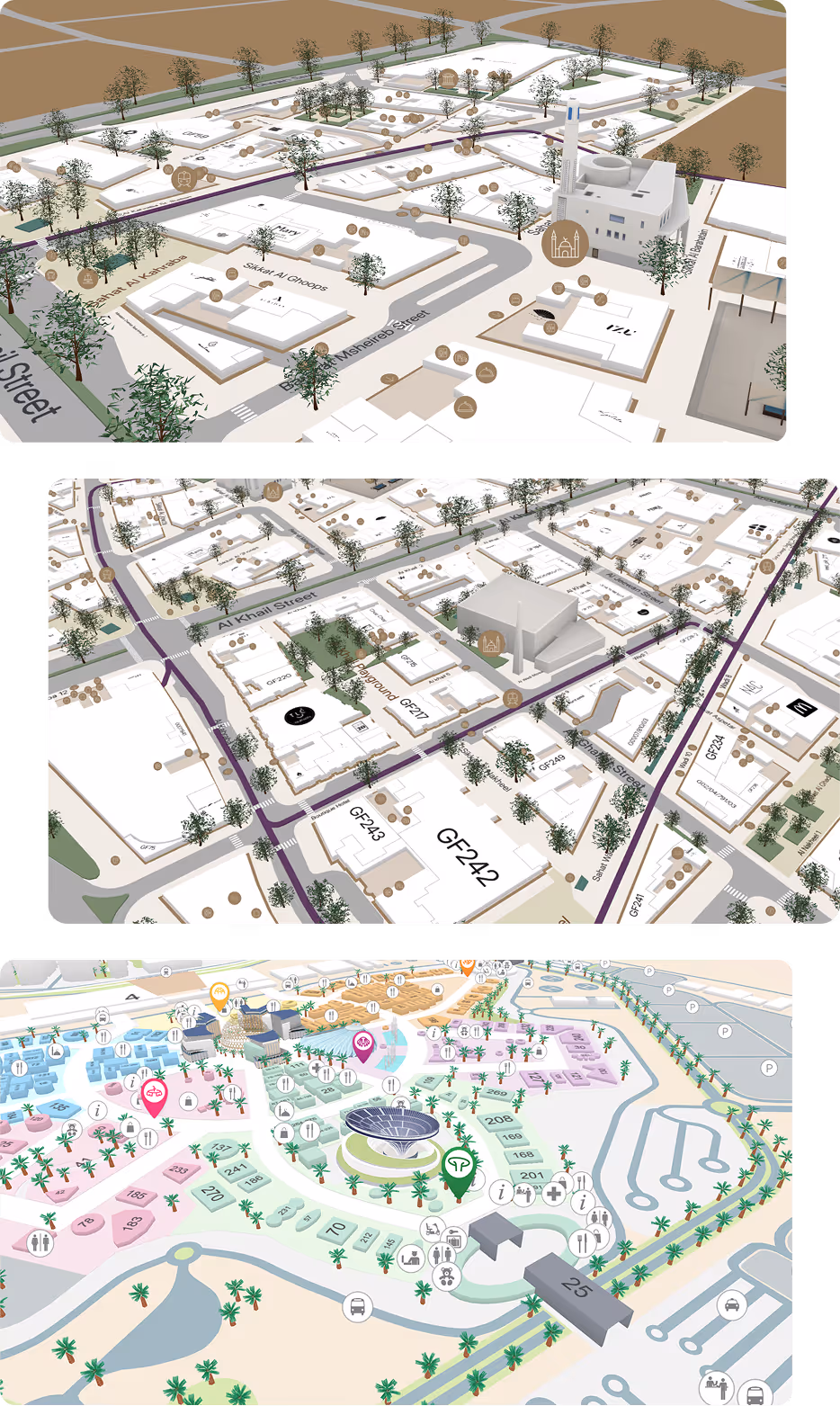
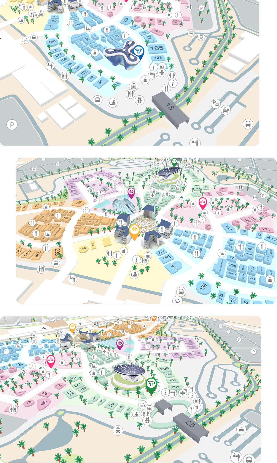
Import your floor plans, trace over them, and publish a stunning 3D map in minutes — no graphic skills required. Update content in real time and keep every screen in sync, without touching a line of code.

Learn more
Floor plan of office spaces including labeled areas for archives, logistics service, managers office, financial department, reception room, roof & rest area, and exit.
Your brand, your map
All colors can be customized to match your brand identity. Use your own set of icons and 3D models.
From 2D to 3D in a few clicks
With a simple 2D drawing environment, creating a beautiful 3D map is as easy as tracing over your floor plans.
Compatible with all file formats
Our design tool is compatible with all major file extension such as pdf, png, and dwg for the most accurate design.
Learn more about workplace efficiency

Turn your map into an engagement engine

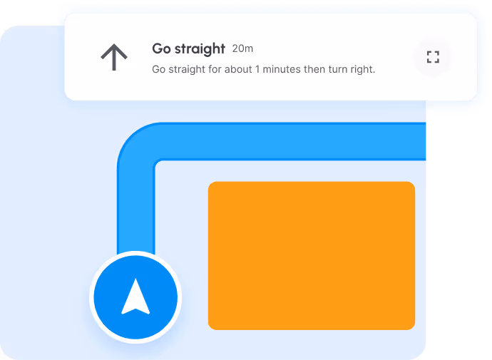
Beautiful maps are just the start. Make them work for you — guiding every visitor, connecting your tools, and delivering the right experience at the right place.

Geofencing that converts
Engage your visitors based on where they are in your venue — automatically.
First Dashboard Image
Deliver location-relevant content that drives engagement
Cut through the noise — show visitors only what matters to them, where they are
Boost conversion by triggering offers when intent is highest
Track zone performance to continuously refine your strategy
Learn more →
Turn-by-turn navigation
Guide every visitor from A to B with confidence — step by step, on any device.
First Dashboard Image
Get visitors where they need to go faster, with less frustration
Eliminate wrong turns and unnecessary detours
Optimize visitor flow with intelligent routing
Adapt routes to specific user profiles or accessibility needs
Learn more →
Spotlight what matters most
Instantly highlight any category of points of interest — so the right destinations always stand out.
First Dashboard Image
Put your key destinations in the spotlight instantly
Direct visitor attention to priority areas effortlessly
Make complex spaces feel simple with clear visual grouping
Improve wayfinding with a cleaner, more intuitive information hierarchy
Learn more →

From beautiful maps to smarter operations

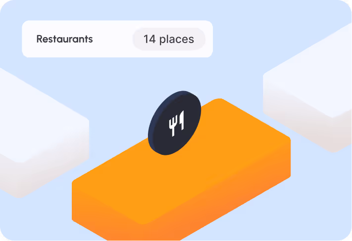
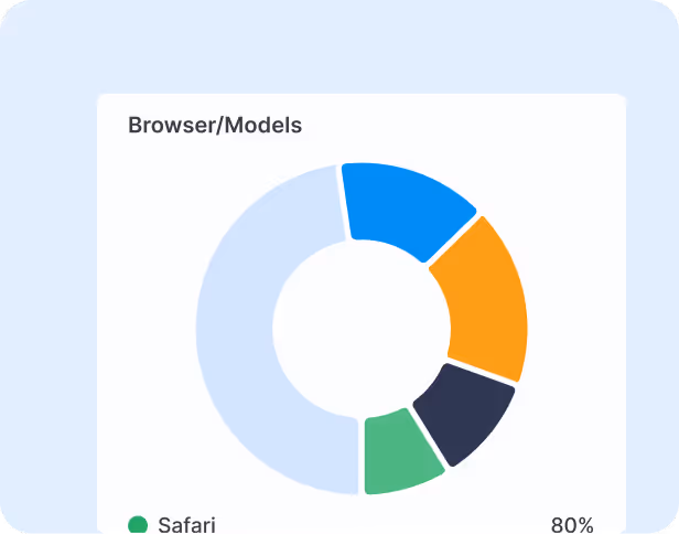
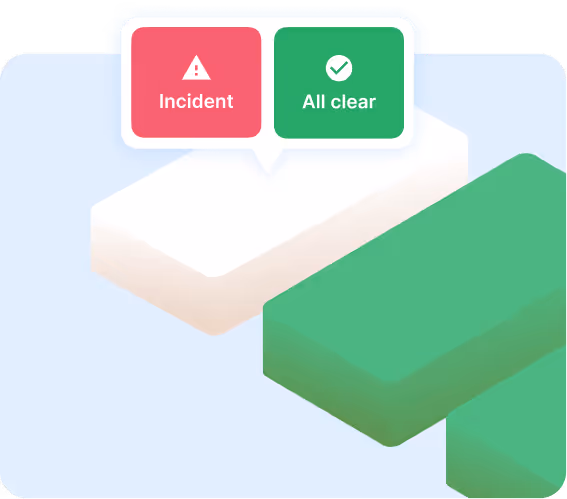
Understand what's really happening in your venue — track your assets, analyze visitor patterns, and keep everyone safe. All the operational intelligence you need, in one place.

Map analytics that drive smarter decisions
Stop guessing how your venue performs — get granular data on how visitors move, where they go, and what they ignore.
First Dashboard Image
Understand visitor movement at a granular level
Identify high-traffic and low-traffic zones to optimize your layout
Replace assumptions with real data for every operational decision
Spot trends and patterns to inform your long-term planning
Real-time asset tracking
Always know where your assets are — on your map, in real time, without switching tools.
First Dashboard Image
Full real-time visibility of every tracked asset across your venue
Optimize asset utilization and streamline your team's workflow
React faster when something moves unexpectedly or goes missing
Asset location data integrated directly into your venue map
Emergency management
When every second counts, your map becomes your most critical tool — giving your teams real-time clarity to coordinate an effective response.
First Dashboard Image
Monitor every zone in real time to identify incidents as they happen
Communicate instantly with intervention teams directly through the map
Track room-by-room evacuation progress — and confirm every space is clear in real time
Continuously refine your emergency plans based on real usage data
Learn more →
Industries

Built for your industry

No matter the industry, our clients rely on our indoor mapping platform to turn their venue into a smarter, more navigable experience.

View Use Case
Three views of a 3D digital map showing a building complex with offices, parking, outdoor trees, and pathways, including navigation and booking interfaces.
Find any room, desk, or colleague in seconds
Employees spend less time searching and more time working — with turn-by-turn navigation directly on their phone or the nearest kiosk.
Make every square meter count
Understand how your spaces are really used with detailed analytics — and make smarter decisions about your office layout.
Get new employees up to speed from day one
A new joiner can navigate your entire campus independently on their first day — no guided tour required.
Learn more about workplace efficiency
Learn More
Floor plan of a shopping mall featuring stores such as Zara, New Yorker, Intersport Iso Omena, Factory Iso Omena, and Salon WestHair Espoo with marked restrooms and elevators.
Turn your floor plan into a revenue tool
Understand which zones attract the most traffic and use that data to optimize your space leasing strategy — and maximize every square meter.
Drive shoppers to the right store at the right moment
Boost visibility for your tenants with targeted recommendations and promotions triggered by visitor location — and watch foot traffic convert into sales.
A map every visitor can use, no matter their needs
Provide adapted routing for visitors with reduced mobility and ensure smooth, safe evacuations — all from one platform.
Learn more about malls
Learn More
3D map of an airport terminal with multiple gates, aircraft, parking areas marked with P, and various colored buildings.
Turn transit time into revenue opportunities
Engage passengers between flights with location-based notifications — from duty-free promotions to click-and-collect points — and turn waiting time into a premium experience.
Real-time awareness across your entire terminal
Give your security teams an accurate, always up-to-date view of your indoor space — so incidents are spotted faster and managed before they escalate.
Fewer missed flights, happier passengers
Guide passengers from check-in to gate with turn-by-turn navigation — reducing stress, minimizing delays, and keeping your on-time performance on track.
Learn more about airports
Learn More
3D rendered aerial views of a hospital complex with surrounding streets, parking areas, green spaces, water bodies, and building floor plans.
Spot bottlenecks before they become problems
Identify high-traffic zones, anticipate congestion, and make smarter infrastructure decisions — all backed by real usage data.
Every patient finds their way, every time
Guide patients, visitors, and staff to any department or service with adapted routing — including accessibility-friendly paths for reduced mobility users.
Get everyone to safety in seconds
In an emergency, every second counts. Guide patients and staff to the nearest safe exit with real-time evacuation routes — automatically updated as the situation evolves.
Learn more about hospitals
Learn more
Three 3D map views showing urban layouts with streets, buildings, trees, and waterways including a labeled chapel, parks, and waterways.
No more hunting for an available classroom
Give students and professors real-time visibility on room availability — find, book, and navigate to any available space in seconds.
A campus everyone can navigate confidently
Provide fully adapted routes for every user — avoiding stairs, obstacles, and inaccessible areas — so no student is left struggling to find their way.
Your entire campus, visible in one place
Give security teams a complete, real-time view of your campus — so they can respond faster, coordinate better, and keep everyone safe.
Learn more about universities
Learn More
Three 3D rendered maps showing urban layouts with labeled streets, buildings, trees, and various icons for landmarks and amenities.
Add new venues without starting from scratch
As your city grows, your map grows with it. Add new buildings, parking areas, or mobility hubs in a few clicks — all connected to the same platform.
One platform, every screen, every district
Deploy your city maps across kiosks, mobile apps, and web — all synchronized from a single source of truth, updated in real time.
Turn any urban space into an effortless journey
From historic sites to shopping districts and parking areas — give citizens and visitors intuitive navigation that makes your city easier and more enjoyable to explore.
Learn more about smart cities
Learn More
Three detailed 3D maps of an event venue showing numbered buildings in different colored zones, icons for amenities like restrooms, dining, information, parking, and transportation, and marked points of interest.
Make every edition better than the last
Track attendee movement, measure exhibitor engagement, and identify what worked and what didn't — so each event is smarter than the previous one.
Help every exhibitor get found
Give attendees instant directions to any booth with step-by-step navigation — so no exhibitor gets lost in the crowd and every visit counts.
No more lost attendees in a crowded venue
Whether it's a trade show, conference, or festival — guide every attendee from entrance to destination with a clear, intuitive map that works on any device.
Learn more about workplace efficiency
FAQ

Still have some questions?

Find the answers to the most commonly asked questions.

How can I edit the map?

By using our Map Editor, changes are easy to manage. Split or merge existing surfaces or add new one and publish them on all devices at once!

How does work the Map Editor license fee?

We propose VisioMapEditor, our Map Editor, on a yearly license fee, which is paid by platform (iOS, Android, Web), and by target (end user, staff, security)

Are Visioglobe maps georeferenced?

Yes, all our indoor maps can be easily geo-referenced: it means that each point on the map has the correct latitude and longitude. This allow our maps to be integrated with indoor location technologies provided by third parties partners or any indoor location technology of your choice.

What is needed by Visioglobe to create my digital indoor map?

Visioglobe needs the floor plans of your building (architectural drawings). Visioglobe prefers to work with AutoCAD files (DWG format), but other formats can be used as well (GeoJson, PDF, ...). Please contact our experts for more information on this point

On which platforms can I use Visioglobe maps?

Visioglobe offers native solutions for iOS and Android (mobile). Visioglobe also provides SDKs for Web and Kiosk (Javascript library leveraging WebGL API).

Get in touch with an expert

Join 1,000+ venues already running smarter operations.

Book a 30-minute call with one of our experts and get a clear picture of what Visioglobe can do for your venue.